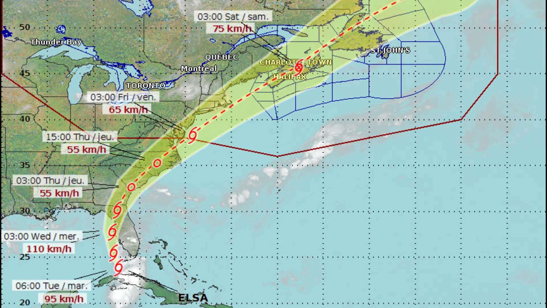
Forecasters are keeping an eye on tropical storm Elsa to see how it could impact the Maritimes later this week.
The tropical system is expected to make landfall in Florida on Wednesday and move northeastward across the southeastern U.S.
It is then forecast to re-emerge off the coast of the Carolinas on Thursday night before accelerating toward the Maritimes.
Bob Robichaud, a meteorologist with the Canadian Hurricane Centre, said the exact track in Canadian waters remains unclear.
“It could be anywhere from offshore Nova Scotia to even central New Brunswick,” Robichaud said in an interview Tuesday morning.
Robichaud said there is a “stronger likelihood” at this time of seeing heavy rain as opposed to strong winds in the Maritimes.
Some of the heavier downpours would be to the left of the track while the stronger winds would be to the right, he said.
Elsa is forecast to be a post-tropical storm by the time it reaches the Maritimes, but Robichaud said that does not necessarily mean it will be a weaker system.
Environment Canada says several post-tropical cyclones have brought extreme record-setting weather to eastern Canada since 2000.
“How long it stays over land and how far inland it actually goes is going to be really critical to see what kind of system emerges off the Carolinas,” said Robichaud.
“Right now, most of our computer models do maintain a clear centre of circulation as the storm emerges back over the water, so we don’t anticipate that this thing is going to die completely over land like they sometimes do.”
The current track shows any impacts from Elsa in the Maritimes would likely be felt starting late Friday, he said.
Robichaud encouraged residents to keep an eye on the forecast over the coming days when the situation will become much clearer.


